Exploring the Geographic Legacy of the Byzantine Empire
Mapping the Byzantine Empire reveals a fascinating tapestry of history, culture, and influence that shaped the medieval world. At its zenith, this remarkable civilization spanned three continents, bridging East and West with its rich traditions and strategic trade routes. By exploring the geographical and political landscapes of the Byzantine Empire, we gain valuable insights into its enduring legacy, from the majestic architecture of Constantinople to the intricate interplay of power among its diverse peoples. Join us as we delve into the intricate maps and narratives that illustrate the grandeur and complexity of this pivotal empire.
How did mapping shape our understanding of the Byzantine Empire?
Mapping the Byzantine Empire revealed its vast territories, trade routes, and cultural diversity, enhancing our understanding of its influence on history and connections with neighboring regions.
- Geographic Extent: Understanding the vast territories of the Byzantine Empire, which at its height included parts of Europe, Asia, and North Africa, highlighting key cities like Constantinople, Thessalonica, and Antioch.
- Cultural Influence: Exploring the diverse cultures, languages, and religions within the empire, including the impact of Hellenistic, Roman, and Christian traditions on Byzantine society.
- Administrative Structure: Examining the complex governance system of the Byzantine Empire, including the roles of the Emperor, the Senate, and local administrators in maintaining control over its vast regions.
- Military Strategy: Analyzing the military organization and tactics used by the Byzantine Empire to defend its borders and expand its territory, including the use of fortified cities and naval power.
What were the key geographical features that influenced the mapping of the Byzantine Empire?
The Byzantine Empire, with its capital at Constantinople, was strategically positioned between Europe and Asia, making it a vital crossroads for trade and cultural exchange. The city’s location on the Bosporus Strait allowed for control over maritime routes, facilitating economic prosperity and military defense. This pivotal geography not only connected the Mediterranean to the Black Sea but also provided a natural barrier against invasions, shaping the empire’s borders and influencing its expansion.
The diverse terrain of the empire further impacted its mapping and territorial control. The mountainous regions, particularly in the Balkans and Anatolia, created natural fortifications that were often utilized as defensive strongholds. Conversely, the fertile plains, such as those found in Thrace and parts of Asia Minor, supported agriculture and population growth, leading to urban development and the establishment of key cities. This varied landscape necessitated a flexible approach to governance and resource management, influencing how borders were drawn and maintained.
Additionally, the empire’s extensive coastline along the Aegean and Mediterranean Seas played a determinante role in its maritime activities. Numerous islands and peninsulas provided safe harbors for trade and naval operations, allowing the empire to project power across the waters. The Byzantine Empire’s geographical features, therefore, not only determined its political boundaries but also shaped its economic strategies and military tactics, creating a unique and resilient civilization that thrived for over a millennium.
How did the territorial boundaries of the Byzantine Empire change over time?
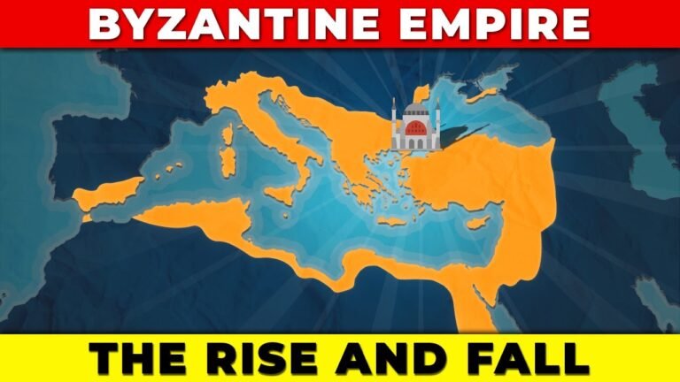
The territorial boundaries of the Byzantine Empire underwent significant transformations from its establishment to its decline, reflecting a dynamic interplay of military conquests, political shifts, and external pressures. Initially, the empire encompassed vast regions of the Eastern Mediterranean, including parts of Europe, Asia, and North Africa, at its height during the reign of Justinian I in the 6th century. However, as the centuries progressed, territorial losses occurred due to invasions by groups such as the Arabs, Seljuk Turks, and later the Ottomans, leading to the gradual shrinkage of its territories. By the late medieval period, the empire was reduced to a fraction of its former size, primarily centered around the city of Constantinople, which ultimately fell in 1453, marking the end of Byzantine rule and the transition of power to the Ottoman Empire.
What tools and techniques were used in the creation of maps during the Byzantine period?
During the Byzantine period, mapmaking was a sophisticated blend of artistic skill and scientific knowledge. Cartographers utilized tools such as compasses, rulers, and astrolabes to create accurate representations of the known world. The use of parchment and ink allowed for detailed illustrations, while techniques like color coding and symbolization helped convey information about various regions, trade routes, and important landmarks. Byzantine maps often reflected the empire’s cultural and political priorities, showcasing not only geographical data but also religious and historical significance.
In addition to these tools, the Byzantine era saw the integration of classical knowledge from ancient Greek and Roman texts, enhancing the accuracy and depth of cartographic works. Scholars meticulously studied earlier maps and incorporated new discoveries, resulting in a hybrid form of cartography that emphasized both scientific precision and artistic expression. This period laid the groundwork for future advancements in mapmaking, as Byzantine maps were not only practical guides but also intricate works of art that communicated the empire’s identity and aspirations to its people and beyond.
Can you explain the significance of trade routes in the mapping of the Byzantine Empire?
Trade routes played a pivotal role in shaping the economic and cultural landscape of the Byzantine Empire, serving as vital arteries for commerce and communication. These routes connected the empire to diverse regions, facilitating the exchange of goods, ideas, and technologies. By linking the East and West, they not only enriched the Byzantine economy with valuable imports such as silk and spices but also fostered cultural interactions that influenced art, religion, and philosophy. The strategic location of Constantinople, at the crossroads of Europe and Asia, further amplified the significance of these trade networks, making it a bustling hub of activity and a melting pot of cultures.
Moreover, the mapping of trade routes underscored the geopolitical importance of the Byzantine Empire in a rapidly changing world. Control over these routes enabled the empire to exert influence over surrounding regions and maintain its status as a major player in international trade. The caravanserais and ports established along these routes became critical points of support for merchants, enhancing the flow of trade and bolstering the empire’s wealth. As a result, the careful delineation and protection of these routes not only secured economic prosperity but also solidified the Byzantine Empire’s legacy as a bridge between civilizations, ensuring its enduring impact on history.
Unraveling the Empire’s Geographic Influence
The vast expanse of the Empire was not merely a backdrop but a vital player in its historical narrative. Spanning diverse terrains—from arid deserts to lush river valleys—the geography shaped economic policies, military strategies, and cultural exchanges. Trade routes crisscrossed these landscapes, facilitating the flow of goods and ideas, while natural barriers often dictated the rise and fall of power. The Empire’s ability to harness its geographic advantages was determinante in establishing dominance and fostering connections among its myriad regions.
At the heart of the Empire’s success was the strategic management of its resources. Rivers served as lifelines, promoting agriculture and enabling transportation, while mountain ranges provided natural fortifications. Cities flourished at key junctions where land and waterways converged, becoming melting pots of innovation and commerce. This intricate interplay between the environment and urban development allowed the Empire to maintain stability and expand its influence, ensuring that its reach extended well beyond its borders.
Yet, the Empire’s geographical prowess was not without challenges. The very features that facilitated growth also posed significant threats, from invasions facilitated by mountain passes to famines triggered by droughts in fertile valleys. As the Empire navigated these obstacles, it adapted its governance and infrastructure to mitigate risks. Ultimately, the geographic influence that once bolstered the Empire became a complex tapestry of opportunity and adversity, reflecting the intricate relationship between land and power throughout its storied history.
The Landmarks That Shaped a Civilization
Throughout history, certain landmarks have emerged as pivotal symbols of civilization, shaping cultures and societies in profound ways. From the majestic pyramids of Giza, which stand as testaments to ancient engineering and spiritual beliefs, to the intricate architecture of the Parthenon that embodies the ideals of democracy and beauty, these structures tell the stories of their eras. The Great Wall of China, a monumental feat of human endeavor, not only reflects the determination to protect a civilization but also highlights the interconnectedness of communities through trade and defense. Each landmark serves as a reminder of humanity’s quest for progress, unity, and expression, leaving an indelible mark on the collective consciousness of generations.
Mapping the Splendor of Byzantium
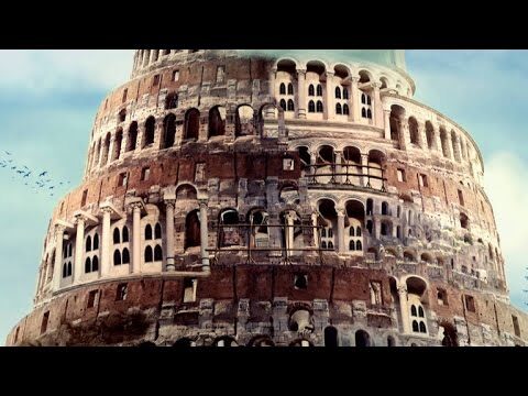
The Byzantine Empire, a beacon of cultural and architectural brilliance, offers a fascinating glimpse into a world where art and faith intertwined seamlessly. Its intricate mosaics and grand churches, like the awe-inspiring Hagia Sophia, stand as testaments to the empire’s innovative spirit and devotion to beauty. Each structure tells a story, reflecting the sophisticated artistry and the complex history of a civilization that thrived at the crossroads of Europe and Asia. The vibrant colors and elaborate patterns of Byzantine art continue to captivate scholars and visitors alike, revealing the empire’s enduring legacy.
Exploring the vast expanse of Byzantium invites a deeper appreciation for its contributions to the modern world. From the preservation of classical knowledge to the establishment of a distinct Christian identity, the empire played a pivotal role in shaping cultural and religious landscapes. Its influence can be seen in the development of Eastern Orthodox Christianity and the preservation of ancient texts, which paved the way for the Renaissance. As we map the splendor of Byzantium, we uncover not only its architectural wonders but also the profound impact it has had on art, religion, and society throughout history.
Tracing the Paths of Power and Culture
Throughout history, the interplay between power and culture has shaped societies in profound ways. From the rise and fall of empires to the flourishing of artistic movements, the influence of leadership on cultural expression is undeniable. Political figures often harness cultural narratives to solidify their authority, while cultural shifts can challenge and redefine power structures. This dynamic relationship creates a tapestry where art, literature, and traditions reflect the values and struggles of their time, revealing the underlying currents that drive societal change.
As we trace these intricate paths, we uncover stories of resilience and innovation that emerge from the tension between authority and creativity. Cultural movements often rise in response to oppressive regimes, serving as a powerful tool for resistance and identity formation. By exploring these connections, we gain insight into how culture not only mirrors the power dynamics of its era but also acts as a catalyst for transformation, inspiring generations to challenge the status quo and envision new futures.
A Cartographic Journey Through History
Maps have long been more than just tools for navigation; they are windows into the past that reveal the intricate tapestry of human civilization. From ancient celestial charts guiding explorers across uncharted waters to modern digital maps that trace the evolution of cities, each cartographic creation tells a story of discovery, conquest, and transformation. As we traverse these historical landscapes, we uncover the cultural, political, and technological shifts that have shaped our world, inviting us to reflect on how geography influences our identity and connections. This journey through the ages, marked by the strokes of cartographers, not only enriches our understanding of history but also inspires a deeper appreciation for the world we inhabit today.
Mapping the Byzantine Empire reveals not only the geographical expanse of its influence but also the intricate tapestry of cultures, trade routes, and historical events that shaped its legacy. As we delve into the rich cartography of this significant era, we uncover the enduring impact of Byzantine innovations on modern civilization and the lessons they offer in resilience and adaptation. This journey through time and space invites us to appreciate the complexities of a civilization that continues to inspire and inform our understanding of history today.